
Maker Friendly Hometown Map Ideas With Tools, Data, and a Four Step Plan
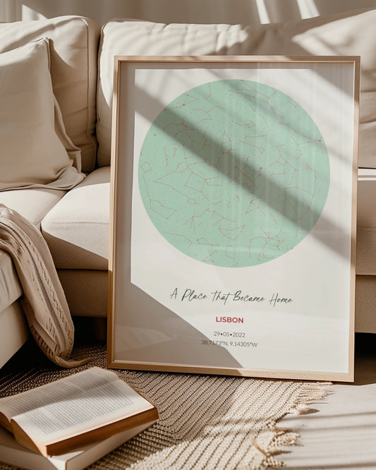
WallfullyThe fastest way to make a memorable hometown map is to pick one personal story or visual style, then design for that story. This guide gives you 20 concrete hometown map ideas grouped by style, the tools and data you need to build them, the cartography basics that keep any map readable, and a compact four-step workflow to get from concept to finished print.
TL;DR:
- Most hobbyist maps should focus on a single route or landmark area to create a more compelling and memorable visual story.
- Using free data from OpenStreetMap and free tools like QGIS allows for easy customization without needing professional software.
- Including elements like a scale bar, north arrow, and legend is essential to keep even artistic maps functional and easily understandable.
- Highlighting key landmarks through size, color, or placement enhances visual hierarchy and guide viewer attention effectively.
- Export your map at 300 dpi with appropriate bleed and choose suitable materials for your craft style to ensure high-quality, print-ready results.
Table of Contents
- 1. Twenty Hometown Map Ideas Grouped by Style
- 2. Tools, Data, and Supplies You Will Actually Use
- 3. The Map Components a Good Design Cannot Skip
- 4. A Four-Step Workflow from Idea to Printable File
- 5. Turning a Map Idea into a Printed Keepsake
- 6. Why a Focused Story Beats a Detailed Map
- 7. Order a Custom Hometown Map Poster
- Sources
- FAQ
1. Twenty Hometown Map Ideas Grouped by Style
Pick a category below based on the look you want, then follow the one-line execution tip to start building.
Minimalist and clean:
- Single-street silhouette: trace just the roads of your block or town in one accent color on a plain background, then print it as a small unframed poster.
- Coastline outline: reduce a shoreline town to its coast, a pin, and a coordinate line, printed on matte paper for a modern look.
- Grid abstraction: crop a downtown grid tight and desaturate everything but one street, framed for a study or office.
Vintage and historical:
- Sanborn-style footprint map: recreate the look of old fire insurance maps by shading building footprints in muted tones, a nod to the detailed town depictions found in the Library of Congress’s Sanborn map guide, printed on textured cream stock.
- Sepia-toned historic district: overlay a current street layout with aged color tones and hand-lettered labels, best as a framed piece.
- Old survey aesthetic: add faux compass roses and decorative borders reminiscent of 19th-century surveys, stitched into fabric for a rustic wall hanging.
Route and memory maps:
- First date route: trace the path of a memorable evening with small icons at each stop, printed as a gift poster.
- Marathon or race route: highlight the course with mile markers and elevation notes, a strong candidate for a framed print.
- Daily commute map: stylize a walk or drive you take often, focusing on texture over accuracy, laser-cut into wood for texture.
Landmark collage:
- Photo-and-map collage: blend a simplified street map with small photos of landmarks around its edges, best suited to a large collage-style print.
- Icon cluster map: replace real buildings with simple icons for the coffee shop, school, and park that matter most, printed small for a gallery wall grouping.
- Layered landmark cutout: use laser-cut layers to raise key buildings above the base map for a dimensional piece.
Story maps:
- Timeline map: show how your town’s footprint changed across decades using overlaid outlines, printed as a large statement piece.
- Family history map: mark houses, schools, and gathering spots tied to generations of one family, framed as a keepsake gift.
- Where-we-met map: pin the exact spots of a relationship’s milestones on one shared map, a popular choice for anniversary gifts.
Mixed-media and craft:
- Embroidered street map: stitch major roads onto fabric hoops for a textile piece.
- Laser-cut wood map: cut street patterns into thin plywood for a layered, tactile wall piece.
- Watercolor hand-painted map: paint a loose, artistic version of your town’s outline, then scan and print it.
- Pressed-flower border map: frame a simple printed map with pressed local flowers for a nature-inspired keepsake.
2. Tools, Data, and Supplies You Will Actually Use
You do not need professional software to build any of these. Start with free data, then choose the finishing tools that match your chosen style.
- Base map data: export street and building layers directly from OpenStreetMap for free, editable vector data.
- Layout and edits: QGIS handles reprojecting, styling, and layering that data without a subscription.
- Quick exports: simple web-based map tools let you export a styled view straight to PNG or PDF for casual projects.
- Historical detail: the Library of Congress’s Sanborn digital collection lets you locate and download historic map sheets for many towns.
- Topographic reference: USGS topographic products offer standardized elevation and terrain layers for route or landscape-based maps.
For craft supplies, match paper to finish: matte cardstock for framed minimalist prints, canvas for larger collage pieces, and plywood sheets for laser-cut designs. If you plan to order a physical print rather than cut it yourself, ask about local versus print-on-demand turnaround before committing to a deadline.
Pro Tip: Export or scan your base artwork at 300 dpi and save as a PDF or high-resolution PNG so your printer does not stretch or blur fine street lines.

3. The Map Components a Good Design Cannot Skip
A hometown map only works as art if it still works as a map. According to USGS guidance on map basics, a useful map includes a scale, a north arrow, and a legend explaining its symbols, and each one earns its place for a specific reason.
- Scale bar: tells the viewer how distance on paper relates to real distance, even on a stylized piece.
- North arrow: orients the viewer without them needing to guess which way is which.
- Legend: explains any icons, colors, or line styles you invented for your design.
- Clear labels: name only the streets or landmarks that matter to your story, not every one that exists.
Design principles for maps recommend emphasizing your chosen landmarks and letting supporting layers recede, a technique Esri calls visual hierarchy. Cartographers treat labels as design elements in their own right, using size, weight, and color to guide the eye rather than listing information flatly.
Two quick fixes make almost any hobbyist map look sharper: strip the basemap down to only the roads and shapes your story needs, and make your focal landmarks the boldest thing on the page through size, color, or isolation from the background.
4. A Four-Step Workflow from Idea to Printable File
Once you have picked a style, this workflow gets you to a print-ready file without wasted effort.
- Decide scope and story: choose whether your map covers a single street, one route, or a small collection of landmarks, since a tighter scope reads better as art.
- Gather your data: pull an OpenStreetMap export, build a simple address list, or download historic Sanborn sheets if you want vintage detail.
- Design the layout: pick your basemap style, apply visual hierarchy so key landmarks stand out, label only what matters, and choose a legible typeface.
- Prepare for print: set your file to 300 dpi, add bleed for your chosen printer, and pick a paper or material finish before ordering or cutting.
5. Turning a Map Idea into a Printed Keepsake
Once you have a design direction, A guided customization tool walks you through adding your streets, labels, and coordinates with a live preview, so non-designers can still land a clean result. Finished pieces print on quality materials with optional framing and eco-friendly production, matching the minimalist, collage, or route styles described above.

6. Why a Focused Story Beats a Detailed Map
A map crammed with every street and label reads like a reference document, not art. The strongest hometown maps pick one route, one set of landmarks, or one era and let everything else fall away, which is what makes them worth framing. A first-date route suits an anniversary gift, a family history map suits a milestone birthday, and a single-street silhouette suits an everyday entryway or office wall.
— Luanda
7. Order a Custom Hometown Map Poster
If you would rather skip the file prep and printer trial-and-error, you can turn any of these ideas into a finished poster through a guided preview tool, quality printing, and optional framing, produced with eco-friendly materials.
A minimalist street silhouette or route map fits neatly into the Route & Map Posters collection, while a landmark collage pairs well with Personalized Photo Collage Posters. Browse either collection to see personalization options like colors, labels, and coordinates before you order.
Sources
FAQ
How do I make a map of my town?
Start by exporting free street and building data from OpenStreetMap, then simplify it in a tool like QGIS to show only the roads and landmarks your story needs. Add a scale, north arrow, and legend as recommended by USGS map guidance, then export at 300 dpi for printing.
What are the components of a good map?
A good map includes a scale bar, a north arrow, a legend, and clear labels, elements outlined in USGS’s map basics guide. These components keep a stylized or artistic map still functioning as an accurate reference.
What are some creative ideas for a map?
Popular approaches include minimalist street silhouettes, vintage Sanborn-style footprint maps, personal route maps of a first date or race, and landmark collages that mix photos with simplified streets. Story maps that track a family’s history or a town’s changes over decades also work well as framed keepsakes.
How do I create a town layout?
Pull a base layout from OpenStreetMap or a topographic source, then edit it in QGIS to remove streets and details that do not serve your design. Apply visual hierarchy by emphasizing your chosen landmarks, a technique described in Esri’s guidance on map design, so the layout reads clearly at a glance.